
Coastal Walkway
Beautiful coastal views, beaches and bushlands
Due to a planned maintenance outage, several Council webpages will be unavailable from Wednesday 8 July 2026. This includes:
- Councillor and Ward information pages - you can access councillor information at 2024-28 Councillors Contact Details PDF PDF, 144.38 KB
- Online Interactive Maps - You may like to try Google maps for general location information
- Council Facility web pages - You may like to try Google maps for general location information or Spaces for hire to book a facility.
We apologies for any disruption this may cause. Should you require any further information about this planned outage, please contact Council's Spatial Team on 1300 722 542 during business hours.

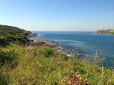
Each year millions of people experience the spectacular views and special experiences of the Eastern Beaches Coastal Walkway. It is one of Australia's most popular attractions. It passes by patrolled beaches, through wetlands, Aboriginal sites, coastal heaths and bushland, offers unique coastal views, and whale watching opportunities during the winter whale migrations. There are cafes, picnic shelters and bbq facilities as well as accessible toilets and change rooms along the Walkway.
The completion of a continuous Walkway from Clovelly to La Perouse is a key priority for Randwick City Council. Many sections of the Walkway are completed in Randwick City, with other sections at different stages of planning and construction.
Check public transport options to sections of the Coastal Walkway at Transport for NSW Trip Planner.
The Coastal Walkway is listed as one of the top things to do in Sydney on Trip Advisor.
Check the Malabar Headland National Park Local Alerts page before your visit as the track is closed when the Rifle Range is in use.
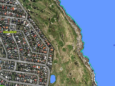
Coastal walks map
Map legend
| Symbol | Meaning |
|---|---|
 | Completed |
 | Not completed |
Clovelly to South Coogee
 Connecting with the Eastern Beaches Coastal Walkway from Bondi to Waverley Cemetery, this 4.5 km section runs along the coast through Clovelly, Gordons Bay, Coogee and South Coogee. Excluding the Gordons Bay section, this part of the Coastal Walkway is wheelchair and pram friendly. You can connect to the next completed section of the Walkway at Maroubra along suburban footpaths through public streets.
Maroubra to Malabar

A 2.4 km section of the Coastal Walkway from north Maroubra to south Maroubra is wheelchair and pram friendly and runs from Mistral Point at north Maroubra, through cliff top parklands down to famed Maroubra surfing beach, with its cafes, skate park and free outdoor gym, and then on to the parklands at South Maroubra.
Since April 2017 you can now continue your walk further south around the rugged but spectacular Malabar Headland National Park. This 3.7km Boora Point Walking Track winds through Australia's newest National Park. Visit the National Parks & Wildlife website for more information and check the Local Alerts page before your visit as the track is closed when the adjacent rifle range is in use. Council has finished building the additional walking track on the western part of the headland. The walk links with the National Parks and Wildlife Service Boora Point Walking Track which follows the coastline, meaning walkers now have the choice of a 3km coastal walk, 1km inland walk or do both for a 4km loop around Malabar Headland.
From Malabar Headland you can continue your walk a further 1.5km through Pioneers Park on Anzac Parade and past Malabar Beach on Long Bay and the Malabar Ocean Pool. Cromwell Park at Malabar Beach has picnic shelters, BBQSs and a great children's playground.
Malabar Headland - Western Escarpment Walking Track
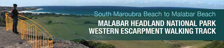
Randwick Council has completed construction on a walking track through the elevated western section of Malabar Headland.This 1.15km walking track has provided a direct connection between South Maroubra Beach and Malabar Beach. The walk was officially opened on Saturday 17 February 2018.
It links with the National Parks and Wildlife Service Boora Point Walking Track which follows the coastline, meaning walkers will have the choice of a 3km coastal walk, 1km inland walk or do both for a 4km loop around Malabar Headland.
The Western Walking Track is not impacted by the ANZAC Rifle Range. It is open seven days a week and has easy, direct access via both Maroubra and Malabar Beaches.
This project was funded by Randwick City Council and the NSW Government under the Metropolitan Greenspace Program. If you would like to get in touch with the National Parks and Wildlife Service, please call the area office on (02) 9337 5511.
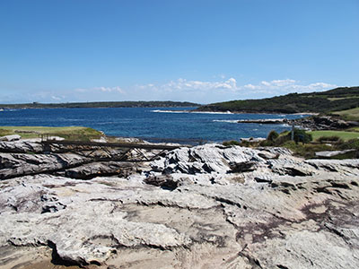
Malabar Headland - Boora Point Walking Track
 The Boora Point Walking Track was opened in April 2017. It is located in the Malabar Headland National Park. The 3.7km walking track is the first public access to the historic headland in over 100 years. To find out more about this fascinating walk, visit the National Parks & Wildlife website. Please note that the walking track is closed when the rifle range is in use. View the National Parks & Wildlife Service local alerts page which contains information on the shooting schedule.
Randwick Golf Course
 The coastal walkway through this golf course is subject to future planning.
The Coast Golf Course
The coastal walkway through this golf course is subject to future planning.
St Michaels Golf Course
The coastal walkway through this golf course is subject to future planning.
NSW Golf Course
This section connects the existing Henry Head walking track in the Kamay Botany Bay National Park which currently ends at Cruwee Cove Beach with a public car park in the National Park near the Westpac Helicopter Rescue Base.


Kamay Botany Bay National Park
 A rough trail runs from the NSW Golf Course to La Perouse which is managed by the National Park and Wildlife Service. See Kamay Botany Bay National Park for attractions.
La Perouse to Yarra Bay

This 2.8 km section passes through an area of national historic significance, with beautiful calm water beaches and panoramic views over Botany Bay and is wheel chair and pram friendly. The Walkway joins the track from Botany Bay National Park and follows the coast along to Bicentennial Park and Yarra Bay. This was an area of first contact between the Aboriginal community and white settlers. See highlights of La Perouse area.