Historic suburbs
Learn about Randwick's most storied suburbs
History of Clovelly
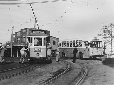
The advent of this suburb can be traced to the extension of the tram line to the coastline. Before this time, Clovelly was known as "Little Coogee". This area was dominated during the nineteenth century by the grand estate of Mundarrah Towers.
 Mundarrah Towers was built for Dr Dickson in the 1860s. Samuel Bennett, who owned The Australian Town and Country Journal, one of the most influential newspapers of the day, bought the property and made further grand additions. The Towers were demolished in 1926, to make way for suburban development. The Mundarrah Towers estate occupied the land around Burnie Street overlooking the western end of Clovelly Bay. Mundarrah Street honours this once grand part of Clovelly's heritage.
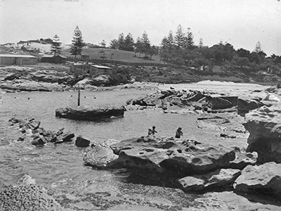
Between Coogee and Clovelly, on the shores of Gordon's Bay, stood Cliffbrook, the home built for John Thompson. By the early twentieth century the first governor of the Commonwealth Bank owned this grand mansion that was demolished in 1976. Cliffbrook and Mundarrah Towers are both part of the hidden heritage of our northern coastal suburbs.
 A public infants school was operating in Little Coogee as early as 1897, in the Mission Hall of the Church of England in Varna Street. Eliza McDonnell was the teacher with an average attendance of 76 pupils. Clovelly Public School officially dates from 1913. The Department of Education provided permanent accommodation for a public school in Arden Street, Clovelly.
Major subdivisions for domestic housing commenced in earnest in Clovelly in 1909. The local progress association argued that there were 717 houses constructed within metres of the proposed tram route that had not yet been completed. Due to these lobbying efforts, the tramline to the Clovelly was completed between 1912-1913. This allowed Clovelly to continue developing throughout the 1920s. The suburb, was named after the seaside village of Clovelly in Devon, England. The name Clovelly was suggested by the president of the local progress association Mr F H Howe in 1914, after several other English places names, such as Eastbourne, were rejected. Clovelly's heyday was really between the end of the First World War and the early 1930s. During the Great Depression Randwick Council instituted a scheme to keep unemployed men employed by building concrete foreshores for Clovelly in an attempt to make access to the bay's foreshores easier for bathers. The Council envisage an Olympic size swimming pool in the bay, a facility that would also keep local men employed in the worst financial times. It was also planned to build a causeway/scenic road across the entrance to the Bay but wild storms in 1938 dashed hopes of this. The remains of the causeway are still visible at low tide, forming a protective reef. The plans were controversial; the merits of this work are still debated today.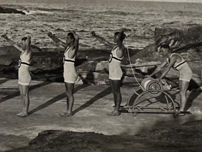 In 1907, a surf life saving brigade was formed at Clovelly, inaugurating the surf life saving tradition in this suburb that has seen numerous heroic rescues, perhaps most notably "the rescue off Schnapper" or "the big rescue" of Sunday 4th December, 1927. Surf Life Saving has been a predominate part of the culture and heritage of this scenic coastal suburb. Competitive swimming is also a dominate part of life in this idyllic coastal location.
Today the suburb is affectionately referred to as "Cloey" by many residents and locals.
History of Coogee
The village of Coogee was officially founded 12 October 1838 when the plan for the settlement was lodged at the New South Wales Colonial Secretary's office. The village was established to prevent William Charles Wentworth from securing a large tract of the Sydney coastline, to add to his already substantial personal land holdings. The name 'Coodgee' is derived from a local indigenous word thought to mean , 'rotting seaweed' or 'place of bad smells'.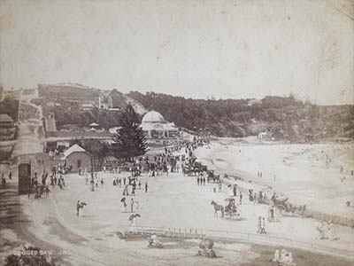
The early days of European settlement in Coogee saw it flourish as a market gardeners paradise. Many of the first residents such as Charles Catley, made their fortune growing vegetables for the Sydney markets. In Catley's case, he made his fortune growing cauliflowers, and as such named his property fronting modern day Brook Street, Cauliflower Hall. Large mansions were being built in Coogee by the late nineteenth century such as Roslyn and Ballamac by wealthy Sydney residents such as Charles Moore and successful businessmen who were establishing their status in society with imposing homes by the seaside. Oceanview, built by the Wirth's Circus family still stands on the crest of the hill overlooking the coast at the corner of Alison Road, Arden Street and Beach Street.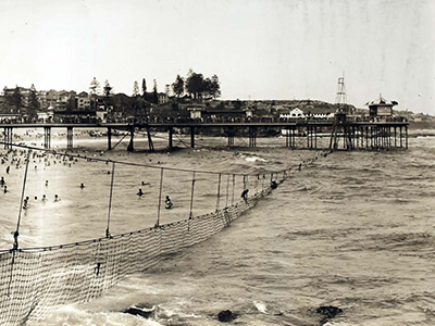
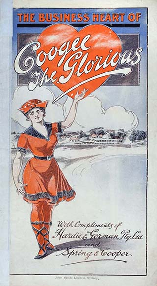
A small suburban shopping centre flourished at the bottom of Belmore Road, now known as Coogee Bay Road. Coogee Public School opened in 1876 and by 1887 the Coogee Aquarium threw open its doors as an entertainment complex, covering an entire suburban block, at the northern end of Coogee Beach. By the 1920s, Coogee was marketed as "Australia's most Beautiful Seaside Resort". The Coogee Pier extended 183 metres into the ocean from the middle of the beach but lasted only a few years (1929-1933) before it was largely destroyed in a sea storm and had to be demolished in 1934. It is testament to Coogee's aspiration to be a British seaside resort in the tradition of Brighton.
Wylie's Baths opened in 1907 by Henry Wylie, and still operate today beyond the southern extremity of Coogee Beach. The Baths were the training ground for Olympic Silver medallist Mina Wylie, the first Australasian woman to win a silver medal for swimming at the Stockholm Olympics in 1912. They have been beautifully restored. The Coogee Surf Life Saving Club was established in 1907 in premises at the southern end of the beach.
Anzac Day 1935 saw one of the more infamous episodes in Coogee's history when a shark held captive at the Coogee Aquarium, disgorged the tattooed arm of a man. In what became known as "The Shark Arm Murder", Coogee's reputation as a pleasurable seaside resort became tainted with the mystery and intrigue of a scandalous underworld crime.
Coogee residents became fearful of attack during World War Two, especially after the Japanese midget submarine invasion of Sydney Harbour, the beach was heavily fortified, leaving the shark net for swimmers in disrepair. By the end of the war Coogee reverted to a suburban coastal playground and the venue for a Christmas carnival from the 1950s-1980s called the Coogee Mardi Gras. In January 1959, this carnival lead to tragedy when a Ferris Wheel collapsed killing and injuring numerous carnival attendees.
History of Malabar
Long Bay is reputed to have been the local Indigenous community's principal camping/healing place between Sydney and Botany Bay. Malabar Headland is the site of a number of Aboriginal engravings. Historian Obed West claimed in 1882 that Aboriginal people referred to Long Bay as 'Boora' and that a rock overhang on the south side of Long Bay had been used as a shelter by Aboriginals suffering from a smallpox epidemic in the late 1700s.
In 1866 an attempt was made to create a village on Church and School Land at Long Bay when the surveyor general called for tenders for clearing timber and erecting posts for street names. This was followed by a sale of allotments in 1869. The suburb was proclaimed as the Village of Brand in 1899, though most people continued to refer to it as Long Bay. People were slow to take up residence in the area and it was not until the tram line was built to the Coast Hospital in 1901 that the suburb started to grow. By the early 1900s the village had two community halls; Anderson's Hall and Picnic Grounds on the corner of Victoria and Napier Streets and Dudley's Hall which provided a home for the school until Long Bay Public School opened in 1909.
During 1910-1920 a number of entrepreneurs bought cheap land at Long Bay and erected tents and huts as accommodation for visitors who flocked to the beach there at weekends. Residents complained about unsanitary conditions and the effect of these holiday camps on land values. During this period there were also a number of more permanent residents living in shacks in the sand dunes behind Long Bay, forced into these living conditions by a housing shortage in inner city Sydney.
Construction of the State Reformatory for Women began in 1902 on a 70 acre site south of the village. This was officially opened in August 1909, followed by the opening of the State Penitentiary for Men in 1914.
The Long Bay Life Saving and Amateur Swimming Club was formed at the end of World War I, meeting at the ambulance building on Bay Parade before a clubhouse was built in 1922. In 1916 the Ocean Outfall was constructed on Malabar Headland and by 1959 increasing sewage discharge had severely affected water quality at Long Bay. A number of club members left to found a new club at South Maroubra and by 1973 the Malabar club had to be disbanded. The commencement of the Deep Water Sewer Outfall in the 1990s saw some improvement in water quality, but the clubhouse was demolished in the same decade after suffering severe water damage.
On 2 April 1931 the MV Malabar was wrecked in thick fog on rocks at Miranda Point on the northern headland of Long Bay. The village of Long Bay was renamed Malabar, after the wreck, in 1933. Another shipwreck occurred on 29 May, 1955, when the fishing trawler Goolgwai ran aground in thick fog and heavy seas at North Point.
During World War One, land at Malabar Headland was used for musketry practice. In World War Two, the headland became the site of the Malabar Battery, in operation from 1942-45. This comprised of two gun emplacements, tunnels, a railway line and a command post. These structures are still in existence, though are in poor condition.
In 1950 golfers formed the Civic Golf Club and laid out the first stage of an 18 hole golf course on the cliff top between Long Bay and Little Bay. This became the Randwick Golf Club in 1960.
History of Maroubra
The origin of the word Maroubra is thought to have come from an Indigenous language word "Marubrah" meaning 'lightening' or 'thunder'. Since 1907, the Maroubra Surf Life Saving Club flag and uniform has honoured this connection.
European history of the area we call Maroubra began in the nineteenth century when Maroubra was the site for woolwashing. This industry needed the plentiful supply of groundwater for manufacturing processes, available in the aquifer under the sands of Maroubra. The remote nature of Maroubra, at that time, suited this industry as it was considered a noxious (toxic) trade.
A series of shipwrecks off Maroubra Beach, the Hereward May 1898, the Tekapo May 1899, established this stretch of coast as a treacherous area for ships to navigate in bad weather.
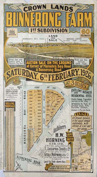
 It was the establishment of Maroubra and South Maroubra Surf Clubs that made the already attractive beach safer for swimmers and potential residents and was the impetus for the establishment of a larger, permanent settlement of the suburb. Maroubra Beach was always the best marketing feature for the potential suburb. In the early twentieth century, local real estate agents, notably Herbert Dudley, started subdividing large tracts of land at Maroubra for residential development, using the proximity of the land to the beach as a drawcard. In an additional effort to lure potential buyers to the remote and swampy location, despite the beautiful beach, Dudley built the Dudley's Emporium opening in 1913, on the corner of Anzac Parade and Maroubra Bay Road. This complex was designed as a magnet for men and women looking to move to the area. The shopping emporium included a butcher, chemist, grocer, haberdashery, theatre. It was an imposing edifice in a remote location, designed to attract residents to the suburb, allowing housewives to shop in their own area.
 Once the direct tramline extended along Anzac Parade, Maroubra was not as isolated. This made the commute to the city easier for working men and made the beach more accessible to Sydney residents. By the 1920s, Maroubra Junction was booming. The Maroubra Junction Hotel opened in 1927. The Maroubra Speedway opened its gates in December 1925. It regularly attracted crowds of 70 000 spectators watching exciting but dangerous racing on the undulating track that is now Coral Sea Park, Maroubra. Races such as "The Golden Helmet" excited the crowds. Unfortunately, the track was considered too dangerous and the speedway had to be closed to car racing by 1928, but was used as a motor cycle track until 1934. Phil Garlick was considered the most daring and reckless driver of his generation but was killed at the Olympia (Maroubra) Speedway on 8 January 1927, when a blowout in his tyre caused his car to mount the embankment.
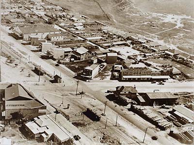 Historically Maroubra was also the location of a state government farm producing vegetables for the Sydney market. Established in 1901, this labour depot was seen as a means of utilising unemployed labour. It was located on land that is now between Maroubra Road and Fitzgerald Avenue.
Maroubra was also the location a migrant hostel, located in Heffron Park, a temporary accommodation facility for newly arrived migrants after World War Two.
 Other existing landmarks at Maroubra include the Anzac Rifle Range, at the Malabar end of Maroubra Beach and the Des Renford Aquatic Centre, named in honour of Maroubra resident and English Channel champion swimmer, Des Renford.
Maroubra Beach has always been a popular spot for surfers and the training ground for many champions of the sport. The Maroubra Surfing Walk of Fame at Maroubra Beach pays tribute to these champions.
History of Randwick
The name 'Randwick' was bestowed upon our suburb by Simeon Henry Pearce who immigrated from Randwick, Gloucestershire, England.
No village of Randwick was officially gazetted, as there was for Coogee, but two things influenced the establishment of Randwick as an English classical village. Bishop Barker of Sydney visited the Commissioner of Lands for NSW, Simeon Pearce and his wife Alice, at Randwick in 1855. They decided to locate the home of the Bishop of Sydney, "Bishopscourt', in Randwick rather than on land in Newtown as intended. Bishop Barker saw the prosperity of the Pearce family, prosperous market gardeners, and the desirability of the land in a high location with ocean and city views.
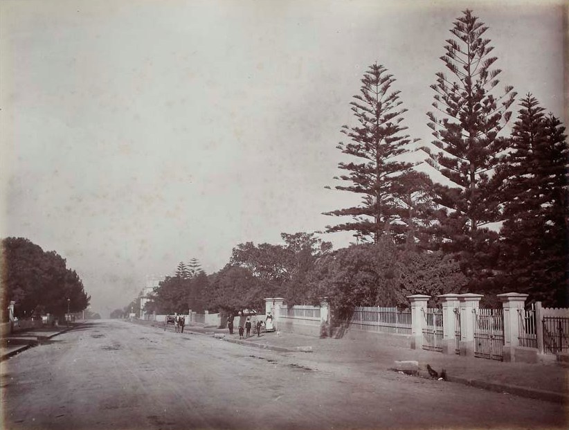
The second critical factor in attracting the well to do of Sydney to the area of Randwick in the 1850s was the establishment of the Randwick Destitute Children's' Asylum, opened in 1858. These grand sandstone buildings, now part of Prince of Wales Hospital, were designed by renowned colonial architect Sir Edmund Blackett. They are still landmark architecture in our City, but they helped Simeon Pearce's case in attracting the well healed members of Sydney Society to the suburb, that in the first half of the nineteenth century, was dominated by market gardeners in their modest houses surrounded by garden plots. Pearce envisaged that Sydney's society elite would build grand houses and thus lay the foundations for a well to do area. He was helped by the elevated geography along a ridge line and the panoramic coastal views.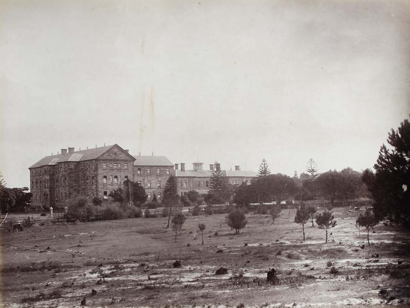 This certainly eventuated with many grand and ornate homes constructed in the Victorian era. Randwick is defined by its lovely serene boulevards, making it one of the most desirable suburbs in Sydney even to this day.
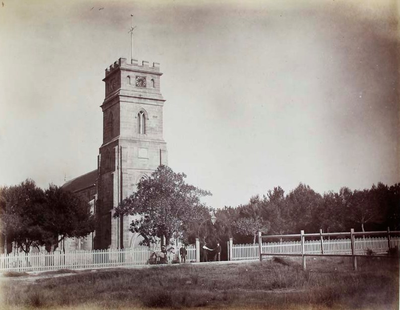
Critical in the establishment of the Randwick village was the construction of the St Jude's Anglican Church in Avoca Street Randwick. The current church was opened in 1865 after much controversy and legal argument over its location. St Jude's became the epicentre of village life in Randwick, just as in the English villages of Pearce's homeland.
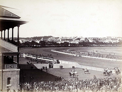
 Randwick Racecourse was another landmark and cultural influence of a different kind, shaping the history of Randwick suburb. Established very early in the colony's history, Randwick Racecourse hosted its first race on 17 April 1833.
Since these times the racecourse has hosted centuries of champions, bookies, jockeys and trainers. Punters from all over Sydney have arrived by coach and horse, trams, cars and soon to be built light rail system. Many legends make for a colourful component to our suburban history, both on and off the track. Successful jockeys and bookmakers at Randwick Racecourse, aspired to and built many of the grand Randwick homes.
Whilst Randwick suburb remains largely residential, the suburb has also been home to industry. The Tramway Workshops were a huge industrial site, employing many men in the construction and maintenance of Sydney's trams.
Other large institutions in Randwick include the upper campus of the University of New South Wales and the Prince of Wales Hospitals.
History of The Spot
Post European arrival, The Spot locality at Randwick was settled in the early 1850s by two families of Irish and Scottish ancestry. It was known as Irishtown with a settlement known as Struggletown located further west near Jane and Middle Streets, closer to the latter Newmarket Stables and now Newmarket residential precinct. This westerly settlement was an area of modest worker cottages inhabited by market gardeners and others - many with strong connections to Simeon Pearce and his family from Gloucestershire in England.
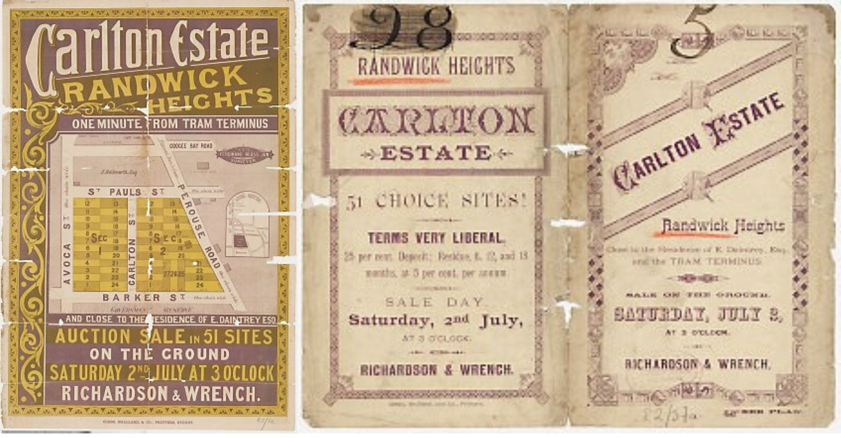
In the eastern portion, by the 1880s, a parcel of land bounded by Avoca, Barker, St Pauls Streets and Perouse Road was subdivided and auctioned for residential development. It was advertised as the Carlton Estate, ‘Randwick Heights’. Randwick Council minutes from the same year refer to the area as ‘Lower Randwick’.
The alignment of Perouse Road is one of the oldest thoroughfares in the district. It partially represents the established routes of our First Nations peoples who regularly traversed this natural thoroughfare of for tens of thousands of years, eventually reaching what we now call “Frenchman’s Road”. The natural route from Botany Bay to Sydney Harbour and back was partially along this alignment and Frenchman’s, following the topography of the terrain. It has long been a natural transport hub.
We have been trying to find the earliest reference to the naming of The Spot.
In 1909, the first published history of the district, Randwick 1859-1909, the author D.M.Cooper (a former Mayor of Randwick and Alderman) has this to say about the locality now incorporating The Spot-
The portion of Randwick south of St Paul Street was known as ‘Struggletown’, and another portion ‘Irishtown’, and retained these names till recent years. Some now refer to this portion of the municipality as ‘Lower Randwick’, but the writer strongly urges all and sundry to give the locality it’s correct name of South Randwick.
Almost twenty years later, the local newspaper South Sydney News for the 24 December of 1927 has ads referring to local businesses at The Spot. This business appears to be what locals later remembered by the 1980s as “The Spot Cash” from their childhood. It is the earliest reference we can find to origin of the name.
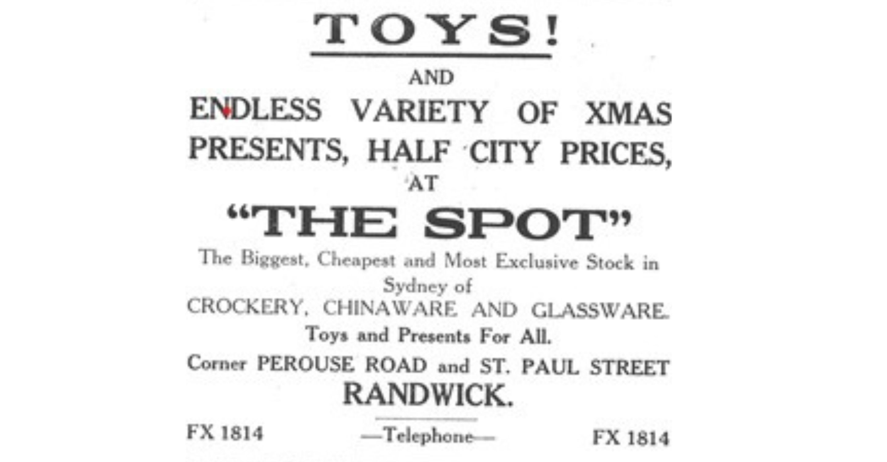
During World War Two, in 1941, the Randwick District News began to compile a History of the Randwick Municipality, maybe as a morale booster. The entry for the 3 July 1941 dealt with the naming of The Spot and is reproduced here in full –
The Spot, so called after The Spot Ironmongery Store in Perouse Road, carried on and christened by the proprietor, Mr F Tyerman, has been known by many names in days gone by.
Originally known as Struggletown, Lower Randwick, Pardy’s Corner and South Randwick, the Spot is destined to one day be the leading shopping centre of Randwick.
The name Struggletown was no doubt adopted in the early days for it was the home of the poorer classes in contrast with the wealthy people living in Randwick proper.
On the land fronting Perouse Road and facing Barker Street was a well which was used to supply the people with water.
Close to Barker Street was a gravel quarry and gravel from it can still be seen on some of the footpaths of the old homes in Randwick.
When the Eastern Suburbs Railway is built, there will be an entrance close to Randwick Station in High Cross Reserve, and no doubt business sites close to it will become very valuable.
Perouse Road is one of the oldest streets in Randwick and was constructed in 1861. In 1900 when Coogee Beach was served by
steam tram service, the Spot used to be a tram section, and the fare from there to Sydney was three pence.
Old residents can oblige by letting us have further information on The Spot.
- Randwick District News, 3rd July 1941
By 1984, the Wentworth Courier published the recollections of an anonymous local who remembered, as a small boy, shopping with his mother at “The Spot Cash” a large general store on the corner of Perouse Road and St Paul’s Street. He also asserts that the shopping village claims its name from this business. On the southern side of St Paul’s Street outside the newsagents he remembers as ‘The Spot’ where locals caught the Coogee tram to the city. On the way home he said you alighted opposite “The Spot Cash” corner.
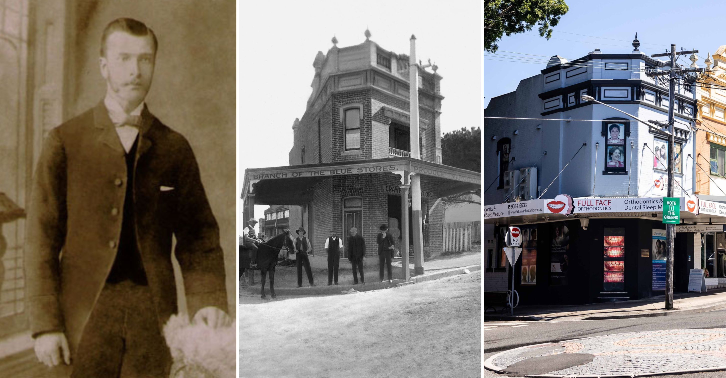
Two other places I remember clearly were Mr Crane’s chemist shop in Perouse Street – probably because he always had a Christmas tree and made sure that from it hung a toy for the children of every customer – and the produce store Crawford and Taylor in Perouse Road.
Ron Crawford – a descendent of the Crawford and Taylor family has generously shared his family images with the Randwick City Library. We have an image of the original shop on the corner of St Paul’s Street and Perouse Road as it was originally from the 1890s. This would be the northern corner of St Paul’s Street and Perouse Road opposite what later became known as ‘The Spot Cash’ business. Crawford and Taylor also had a very large warehouse in Avoca Street. They supplied produce for horses, still being used as transport in the early twentieth century, and the local horse racing industry. Business boomed and the company, founded by William Crawford, participated in local processions and celebratory occasions for decades.
Crawford and Taylor supplied produce for horses, still being used as transport in the early twentieth century, and the local horse racing industry. Business boomed and the company, founded by William Crawford, participated in local processions and celebratory occasions for decades.
The era from the 1914-1920s was a boom era for the businesses in the Randwick municipality. The Spot was leading the local shopping precincts with Pauline Curby (2009) acknowledging the ‘mushroom-like growth’ in the business centres particularly in the St Paul Street shopping precinct in Lower Randwick.
Sand’s Sydney Directory (a precursor to the old white pages telephone directory) lists the business owners on both sides of St Paul’s Road and Perouse Road as well as the residents at both ends of the shopping strip. In 1920 there was amongst others: a butcher, newsagent, confectioner, fruiterer, savings bank, tobacconist, hairdresser and general grocery stores. It may be interesting for locals to note the house names of properties in St Paul’s Street. This was an old-fashioned means of the postal staff finding your house to deliver correspondence in the days of snail mail - long before the advent of email and the internet. Have a look next time you are walking around to see if you can ‘spot’ some current house names.
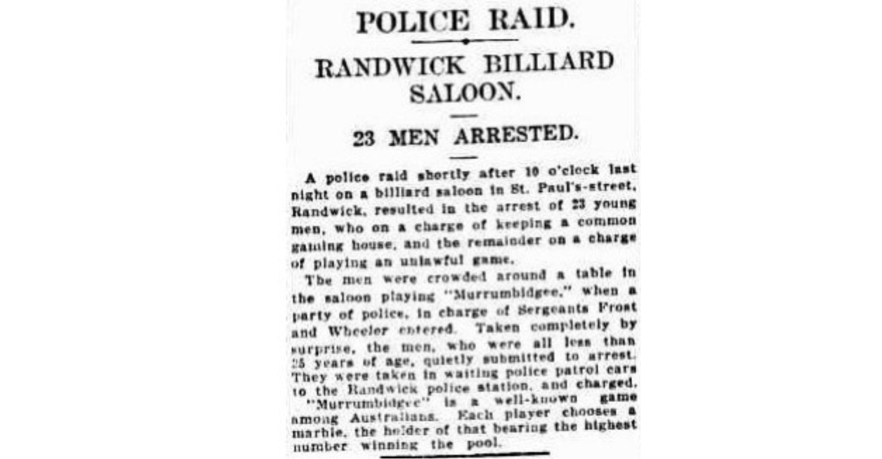
Whilst businesses flourished at The Spot in 1920s Randwick, one business – the billiard hall – became known for all the wrong reasons. It was a wild old winter’s night at The Spot, Friday 17 August 1928, according to The Sydney Morning Herald of the next morning, when 23 young men were arrested for illegal gambling at the billiards hall. This was reported as part of a ‘crime wave’ that was sweeping Randwick and causing sleepless nights for local politicians and police. Local residents were making desperate representations to Randwick Council and local MPs at all levels to ‘do something’ to restore law and order. Eventually calm prevailed.
The same billiard hall- listed as 34 St Paul’s Street in 1930 – and large as it was - later became the perfect location for the iconic Salvio’s Ballet Slipper factory. Salvio’s became renowned throughout Sydney by all aspiring young dancers for several generations - supplying beginner dancers right through to The Wiggles and The Australian Ballet. The Spot and its businesses were emblematic of the times, with migrants such as Enricho Salvio carving out a successful and peaceful new life for their families. Salvios operated in Randwick from 1943- 2016, after starting in Melbourne. To this day, The Spot festival aims to showcase and embrace all that we celebrate about our multicultural society.
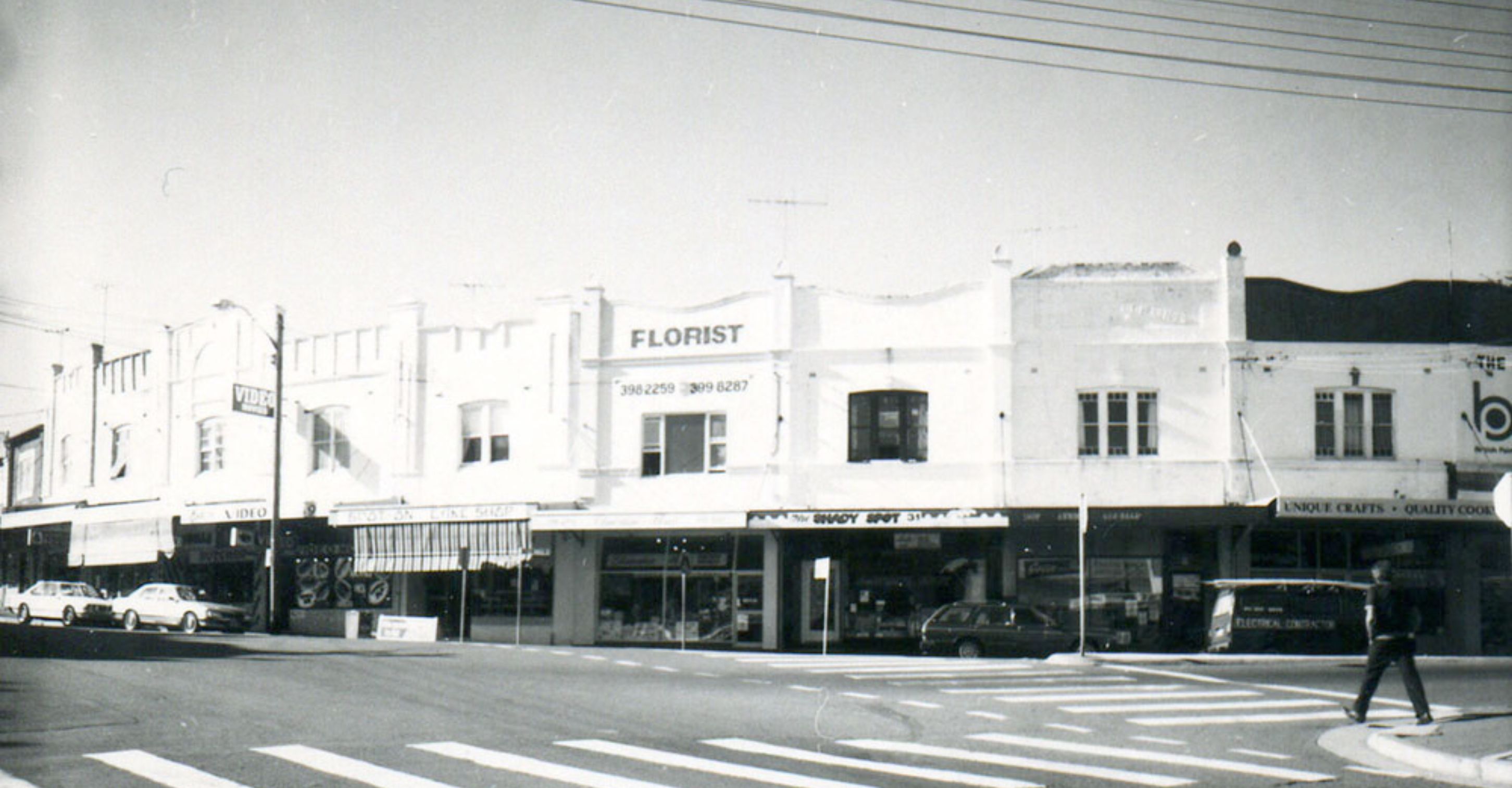
The architecture of The Spot shopping precinct has remained largely unchanged, the genesis of its charming village vibe. We can mark the passing of decades in the types and styles of business and the societal trends in leisure activities. Those old enough will remember the good old days of the video shop seen on the bend, in this 1980s view of The Spot taken by the library over 40 years ago. These are the days before streaming services when you got your movies from the local video shop. The businesses at The Spot may have changed over time but the shop fronts remain largely unchanged – save for a lick of British Paints as advertised above the shop awnings in the 1980s.
One business that has stood the test of time and leisure trends is the iconic art deco Ritz Cinema. Designed by architect Aaron Bolot, The Ritz opened in 1937. It is now one of the few remaining art deco cinemas in Sydney. By the 1980s the theatre was facing the threat of demolition, having outlived Coogee’s Boomerang Theatre and Randwick’s other theatre The Odeon, in Belmore Road. Community action to save the iconic art deco Ritz Cinema was widespread and persistent. The Ritz has drawn generations of locals to The Spot in their leisure hours. Thank goodness for Randwick’s community spirit, saving this icon of our local heritage!
Today, The Spot has emerged as a pre-eminent retail district as predicted all those years ago in 1941. It also remains as a ‘hub’ or ‘spot’ for transport and social interactions. Locals can still be heard saying, “Meet me at The Spot”
The Australian Film Walk of Fame was inaugurated in 2008, celebrating Australian stars of film who are commemorated with stars in the pavement outside The Ritz Cinema, at The Spot. The latest 2022 inductee to the Australian Film Walk of Fame was Leah Purcell (2022)
Randwick Council also launched The Spot Festival in March 2008. It has grown to become one of the marquee events on the City’s calendar of community events, celebrating history, diversity, culture, and great food.
